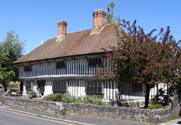
 Today’s image for Day 332 of the VM_365 project shows the farmhouse of Lower Gore End Farm, Minnis Bay, Birchington which was established around 1540 or earlier.
Old Bay Cottage along with Elder Cottage formed the farmhouse of Lower Gore End Farm, all that remains of this farmstead which would originally have been isolated, away from the focus of the village at Birchington to the east.
The farmhouse was originally detached and was located with its gable end facing on to the farmyard. Historic maps indicate that working farm buildings were located on two sides of the farmyard which faced side on to the route from the village of Birchington to Minnis Bay, now known as Minnis Road.
Old Bay Cottage, on the right of the image, is the oldest part of the farmhouse and was built in the 15th century as a two storey timber framed cottage with a tiled hipped roof and close studded timbers. The porch, which is just visible, was a later addition. The thatched roof visible on the left side of the image belongs to the 18th century extension known as Elder Cottage.
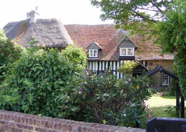
Lower Gore End Farm was quite isolated in the early to mid 19th century and surrounded by agricultural land, with Minnis Creek nearby still flooding nearly as far as the farmstead at the spring tides. It was probably still possible to have a clear view of the parish church of All Saint’s, Birchington from the farm although by the 1870’s new roads were beginning to be laid out at Minnis Bay, west of the relatively new railway line and brickfields were beginning to encroach on the agricultural land. By the late 19th century the farm was nearly surrounded by brickworks and by the 1950’s was surrounded on the north, east and west sides by suburban development focussed on Minnis Bay.
Nowadays the farmhouse is all that survives of the farmstead, completely surrounded by suburban development but still remains as an indicator of the once isolated rural character of Minnis Bay.
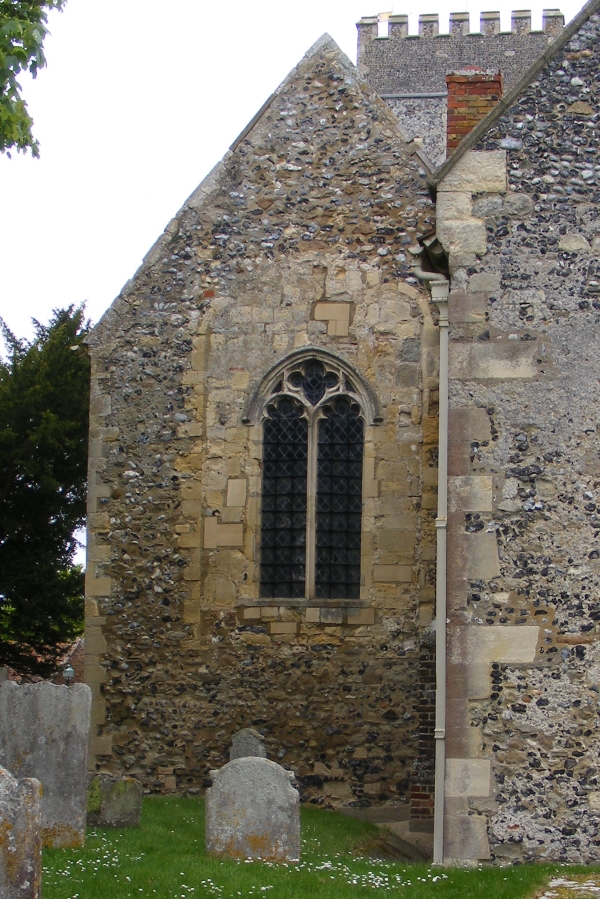 The image for Day 329 pf the VM_365 project is a view from the east end of the south chapel of the Parish Church of St Nicholas at St Nicholas at Wade. The
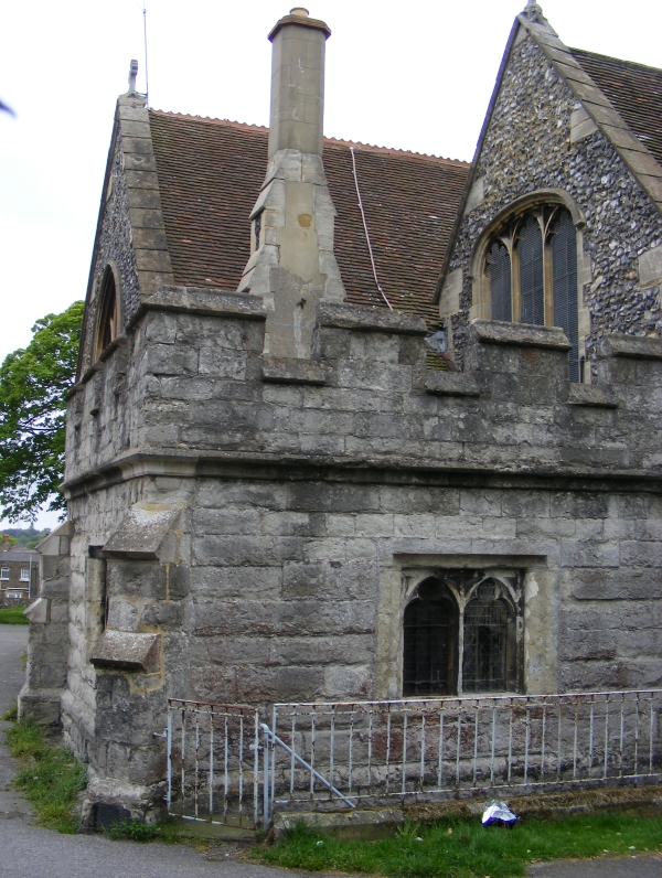
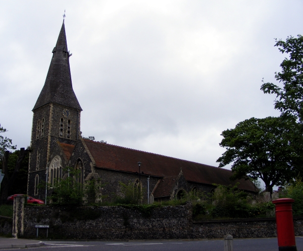 Today’s image for Day 324 of the VM_365 project shows the large parish church of St John the Baptist, Margate. It is located on high ground about a mile inland from the coast and would have been widely visible throughout the parish before the town became more built up in the 19th and 20th centuries. The church was constructed mainly in knapped flint with some ragstone used later.
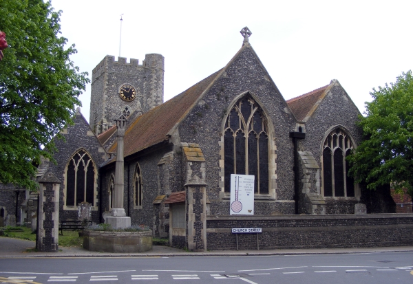
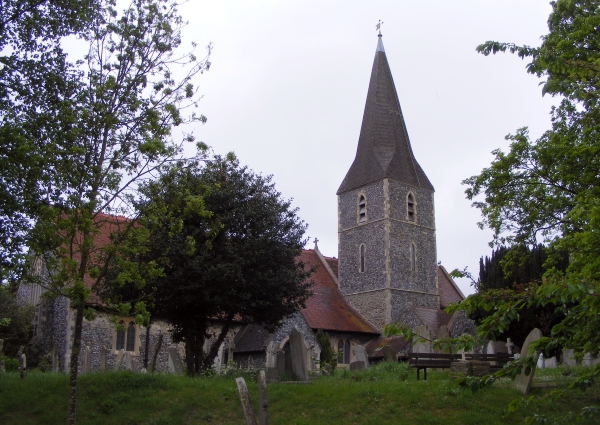 The image for Day 323 of the VM_365 project shows the parish church of All Saints, Birchington. The church is located on high ground approximatley 1.2 km (¾ mile) from the coast and although now heavily built up, the landscape would have been open all the way down to the sea until around the mid 19th century. The churchyard is large and open and has been terraced along the hillside to accomodate the 19th century extension to the graveyard.
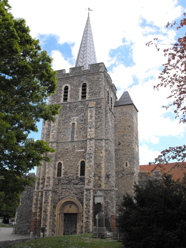 The image for Day 322 of the VM_365 project shows the eastern end of the church of St Mary the Virgin, Minster in Thanet. The church was constructed with a mixture of water rounded flints and Thanet beds sandstone, with Caen stone , Reigate stone and Ragstone used as dressings in the medieval period. Bathstone was used to construct some of the 19th century elements.
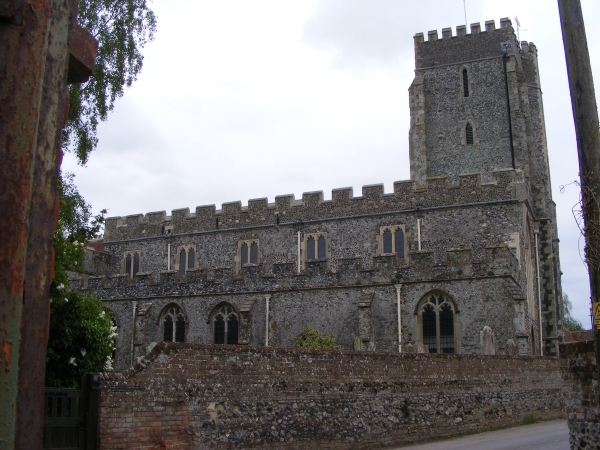 Today’s image for Day 321 of the VM_365 project shows another of our standing archaeological remain, this time the church of St Nicholas, St Nicholas-at-Wade, near Birchington. The earliest church at St Nicholas was built in the late 11th century and parts of it survive in the lower portions of the west wall of the nave. The original church was constructed of large flints and sandstone from the Thanet Beds.