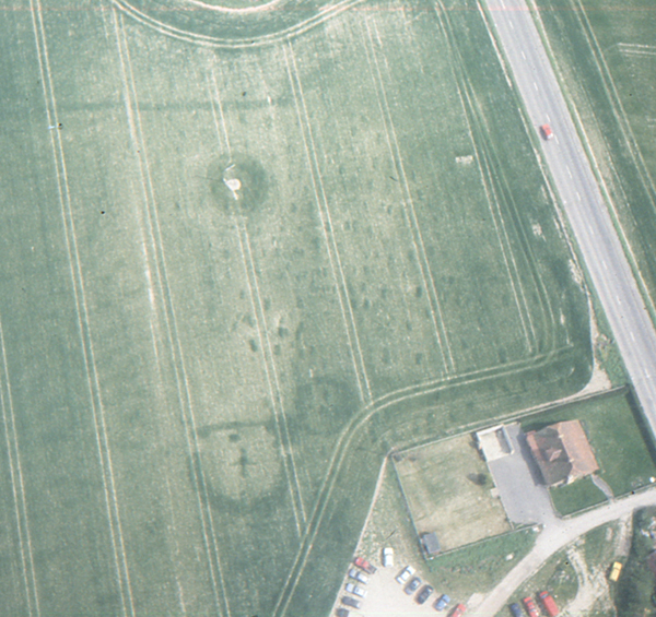
Today’s image for Day 260 of the VM_365 project shows cropmarks at Sarre recorded during an aerial reconnaissance flight by the Trust for Thanet Archaeology in 1990.
The cropmarks, located to the east of the existing Sarre Mill, show an Anglo Saxon cemetery in the north east quadrant of the picture and a medieval post-mill foundation showing as a ring ditch with a cross in the centre in the south west quadrant.
Evaluation trenching by the Trust in 1990 sampled a number of the Anglo Saxon graves which have previously featured in VM_365 posts and also sampled the cropmark of the post-mill.
The Sarre post-mill is of similar form to the post-mill that was excavated at St Peters, Broadstairs. The ring ditch and cross trench at Sarre contained pottery in 13th and 14th century fabrics indicating that a windmill has stood at Sarre from at least the 13th century.