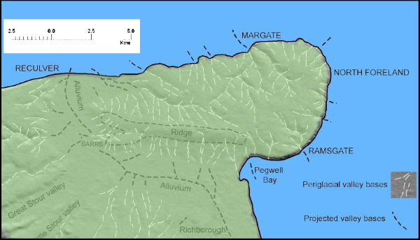
The map shown here for VM_365 Day 62 is of the underlying shape of the landcape of the Isle of Thanet, a factor which has shaped its history and culture over many centuries.
The shaded relief of the map was created using height data taken by the NASA space shuttle as it orbited the earth. Unlike yesterdays image which showed the locations of all the discoveries of archaeological remains from a particular historical era, the Roman period, this map shows the enduring structures of the Isle of Thanet’s landscape.
Modern development has sometimes disguised the natural shapes of the chalky slopes and valleys that divide up the space that has been occupied in Thanet for over six thousand years, but with careful observation you can still recognise its major features, although less so as new housing estates and roads change the natural rhythms of the landscape each year.
If you are out and about on the Isle, look around and see how the land rises and falls and in places gives amazing views over the slopes and to the sea. Observe how the various towns and areas occupy particular slopes or are separated by valleys. Follow the routes of the Islands older roads over the ridges and up the slopes of the network of valleys that underpin the landscape.
The ancient inhabitants of Thanet were acutely aware of the shape of their landscape and chose the sites of their settlements, ceremonial sites and burial grounds with their location on specific landscape features in mind. Lines of sight between locations were important, as were vistas where large distances could be see all around. Access to resources or to the sea and the flat grounds at the top of the hill shaped the way the Island’s people moved around. Sometimes the relative effort of getting from one place to another dictated the way settlements grew up around the area.
To understand the distribution of sites in one particular period we need to understand that the one relatively constant factor in the development of society over time was the influence of the physical shape of the land. Understanding the shape of the land can explain the choices made when settling the landscape as well as the changes that happened over time.