Return to Introduction
Display Contents
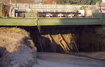
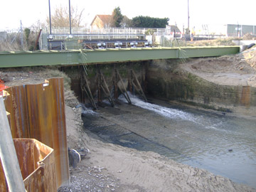
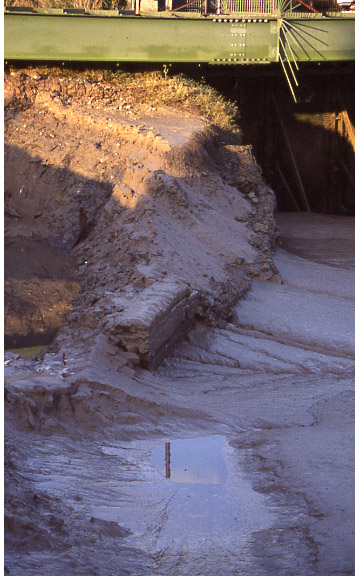
Road Bridge
Modern Sluice Gates
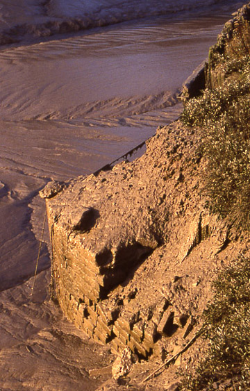
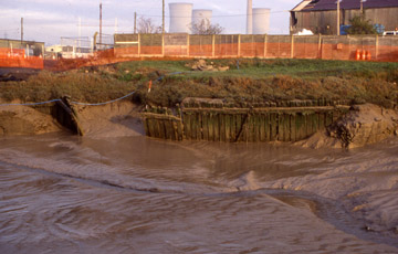
Brick Retaining Walls
Timber Line 1
Timber Line 2
Timber Line 3 &4
German Torpedo Boat
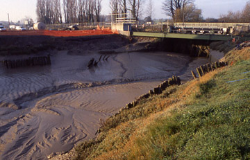
The flow of water through the Stonar cut is controlled by a set of steel sluice gates operated by an array of electric motors The gates remain closed until required to relieve flood waters built up in the upper reaches of the Stour west of the cut.
The recent flushing of the sluice by the Environment Agency scoured away the silt in the base of the cut exposing a concrete lining. The concrete lining appears to be made of precast units with cobbles set in the surface.
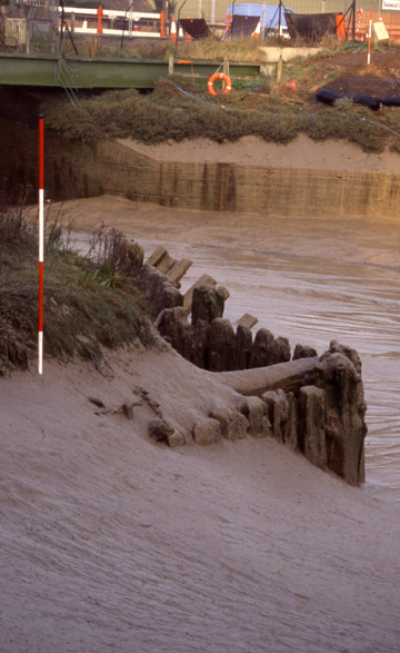
The sluice gates are contained between two curvilinear retaining walls built of brick; these appear originally to have flared out from the sluice in a sinuous curve terminating on the northern side with a sharp curved pier.
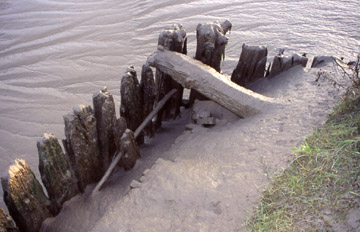
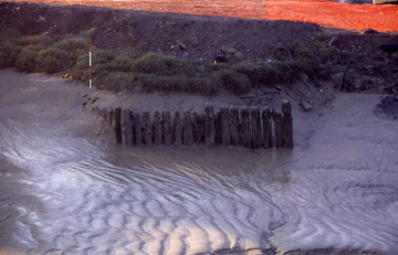
Within the silted channel of the cut a row of rectangular section timber piles formed an irregular line extending approximately 1m from the mud.
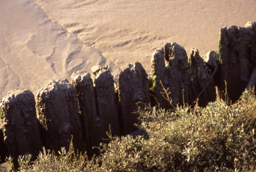
Timber line 2 was composed of 26 close set rectangular section timber piles forming a right angled structure.
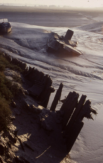
A row of rectangular section piles was located behind a large breach in the brick wall facing the north bank of the cut. This row of piles had at one time been continuous but the central section has been lost creating two separate units. Timber line 3 consisted of eleven piles with a horizontal rail bolted to the upper part of the face.
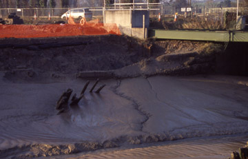
German
Torpedo Boat
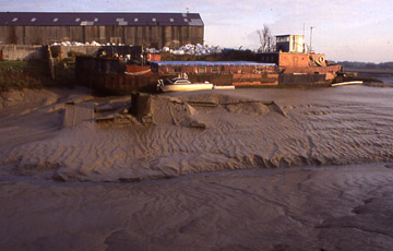
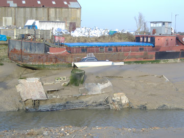
The wreck of a steel hulled vessel, reputed to be a WWII German torpedo boat, lies in the silt on the northern side of the channel. This boat was originally salvaged in the post war period and stored in Ramsgate harbour. It was towed to its present location and abandoned. Some unsuccessful attempts have been made to salvage the vessel; in November 2005 it lay firmly fixed in the silt of the cut.
The wreck of a steel hulled vessel, reputed to be a WWII German torpedo boat, lies in the silt on the northern side of the channel. This boat was originally salvaged in the post war period and stored in Ramsgate harbour. It was towed to its present location and abandoned. Some unsuccessful attempts have been made to salvage the vessel; in November 2005 it lay firmly fixed in the silt of the cut.
Butler, R. 1999. Richborough Port. Pfizer Ltd, Sandwich.
Chamberlain, D. M. 198?. The Ancient Town and Port of Stonar. East Kent Maritime Trust.
Hardman, F. W. and Stebbing, W. P. D. 1940. Stonar and the Wantsum Channel. Part I – Physiographical. In Archaeologia Cantiana Volume LIII pp 62-80.
Version 1. Posted 28.02.06
All
content © Trust for Thanet Archaeology